Traveling Around London: Essential Transport Options & Tips
Public Transport Overview
London’s transport network is massive,sometimes almost overwhelming for newcomers. The city’s Tube, buses, local trains, and river services, all under Transport for London (TfL), make getting around both convenient and, well, sometimes a little confusing.
Contactless payments, fare caps, and a web of zones are just a few things that shape daily journeys here. Knowing the basics can save you money and time.
Understanding Zones and Fares in London Transport
The city is split into nine fare zones, with Zone 1 being the heart of London. Most tourists stick to Zones 1 and 2, but you might find yourself venturing out to Zones 5 or 6 for Heathrow or Wembley.
Fares change depending on which zones you cross and the time of day. Peak hours,Monday to Friday, 06:30,09:30 and 16:00,19:00,mean higher prices, while off-peak is cheaper and covers weekends too.
Checking fares is easiest through the TfL Go app or the official journey planner. Citymapper is another favorite among locals for finding fast, cheap routes.
One of the best features? Daily and weekly fare caps. Use contactless or Oyster and you’ll never pay more than the set limit, no matter how much you travel.
Contactless Payment & Oyster Card Options
Most people use either a contactless debit/credit card or an Oyster card. Both work on buses, trains, and the Tube, and both offer the same daily caps,so there’s not much difference in cost.
Oyster does require topping up, but it’s handy if you want to load a 7-Day Travelcard. For quick visits, just tapping your bank card is easier.
Just tap in at the yellow reader at the start and end of every trip,except on buses and trams, where you only tap in. Tourists can also order Visitor Oyster Cards ahead of time. Payment details are laid out in the London public transport guide.
Accessibility Across London’s Network
London’s made strides in accessibility, though it’s not perfect. Around a third of Tube stations have step-free access, while most Overground and buses are wheelchair-friendly.
- Low-floor buses for easy wheelchair access
- Priority seating on public transport
- Step-free maps from TfL
- Free travel for wheelchair users and visually impaired passengers
Apps like TfL Go and Citymapper let you filter for step-free routes. That’s a lifesaver if you’re traveling with a stroller or heavy bags. TfL’s guides and maps for disabled travellers show which stations have lifts and accessible toilets.
Using the Tube and Underground Trains

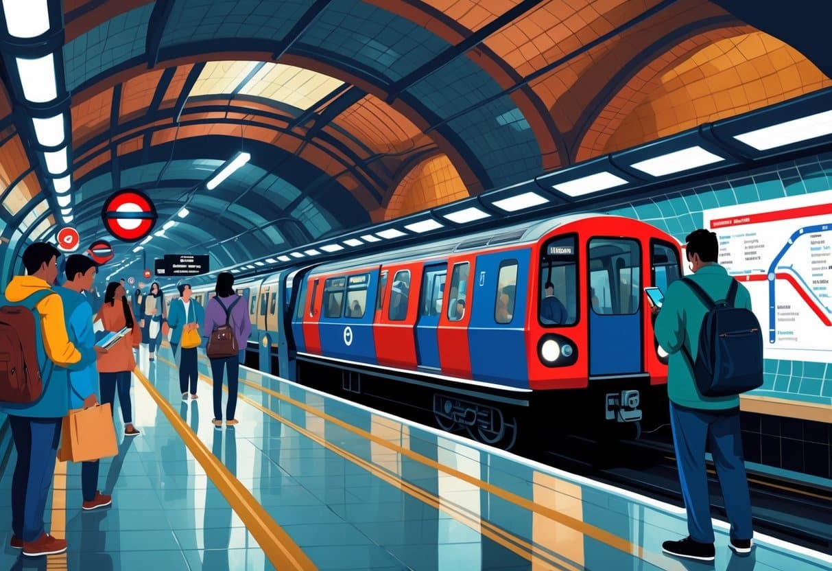
The London Underground,or just the Tube, as everyone calls it,is generally the quickest way to zip across the city. Trains run every few minutes, and you can pay with Oyster or contactless, so there’s rarely a need to fuss with paper tickets.
Navigating the London Underground System
The Tube map is a rainbow of colored lines, each representing a different route. Most major sights are in Zone 1, but you’ll be glad for the full map if you’re heading to the airport or a gig in Wembley.
Free paper maps are everywhere, but honestly, most locals just use the TfL Go app for live updates. Walking between stations can sometimes be faster,TfL’s walking maps come in handy for that.
Stations are well-signed, but not all are step-free, so check ahead if you’ve got heavy bags or mobility needs.
Tips for Efficient Tube Travel
On escalators, stand to the right,Londoners get feisty if you block the left. Inside the carriages, move down to let others in, especially during busy times.
Tap in and out with your card; Oyster and contactless are fastest. Paper tickets are still a thing, but they’re pricier and most people skip them. Carry a small bag,those narrow corridors aren’t made for giant suitcases.
First time? The tourist Tube guide is solid for the basics.
Peak vs Off-Peak Tube Times
Weekday rush hours,07:30,09:30 and 17:00,19:00,are packed, and fares go up. If you can, travel after 09:30 or on weekends for cheaper, less crowded rides.
Late-night Tube runs until about midnight, and the Night Tube operates on select lines Fridays and Saturdays. For the latest on schedules and fares, check out London Underground travel guides.
Buses, Overground, and DLR: More London Transport Options
London’s not just about the Tube. Buses, Overground, DLR, and trams fill in the gaps, especially for trips that don’t make sense on the Underground.
Each mode connects different neighborhoods, so it’s worth knowing what’s out there.
London Buses and the Hopper Fare
With more than 650 routes, London’s iconic red buses reach nearly every corner of the city. Sometimes, they’re the only way to get from A to B without a long walk or awkward Tube change.
Buses have a flat fare,no matter how far you go. You’ll need an Oyster, contactless card, or mobile payment; cash isn’t accepted. The Hopper Fare is a real perk: unlimited bus and tram rides within an hour for the price of one fare.
To catch a bus, just stick your hand out at the stop. Inside, hit the red button when you want to get off. Real-time info is on the TfL journey planner and Citymapper app.
London Overground Routes
The Overground is a lifesaver for getting across north, east, and south London without slogging through the city center. It’s run by TfL, uses the same payment system as the Tube, and shows up in orange on maps.
Trains run regularly,though not as often as the Tube,and connect to the Elizabeth line, DLR, and National Rail. Most stations are step-free, so it’s a good pick for anyone needing easy access. For a full network breakdown, see London TravelWatch.
Docklands Light Railway (DLR) Details
The DLR covers east and southeast London, including Canary Wharf, Greenwich, and London City Airport. It’s automated (no driver!) and kids love sitting at the front for the view.
Trains run every 4,10 minutes and connect with the Tube, Overground, and buses. You’ll need to tap in and out on the platforms using Oyster or contactless. For more, check out this guide to getting around London.
London Tramlink Services
Trams mostly run in south London,think Croydon, Wimbledon, Beckenham, and New Addington. It’s not a huge network, but it’s reliable and connects local town centers.
Trams are frequent, step-free, and accept Oyster and contactless. The Hopper Fare applies here too, so you can easily switch between trams and buses. Live updates are on the TfL website.
River and Boat Transport Choices
River services offer a different perspective,literally. Commuter boats and sightseeing cruises run along the Thames, letting you spot landmarks and skip traffic.
It’s not the cheapest way to get around, but sometimes it’s just worth it for the view. For timetables and ticket info, check out VisitBritain’s London transport guide, Lonely Planet’s London tips, or the BBC’s travel feature on river commuting.
Thames Clippers and River Boats
London’s river transport scene is largely shaped by Uber Boat by Thames Clippers, which makes getting around the city by water surprisingly straightforward. These river buses link Putney in the west with Woolwich in the east, stopping at hotspots like Westminster, London Bridge, and Greenwich.
Whether you’re commuting or just soaking up the sights, the Thames Clippers offer a practical alternative to the Underground. You can pay with Oyster or contactless cards, and fares are split into West, Central, and East Zones,a bit like the Tube, but with a view.
Most boats come with comfy seating, toilets, and a small café, which honestly makes the journey more pleasant than you might expect. River buses are also fully accessible, with step-free boarding for wheelchairs and prams.
Here’s a quick fare breakdown:
| Zone | Adult Single | Child Single |
|---|---|---|
| West | £5.20 | £2.60 |
| Central | £7.70 | £3.85 |
| East | £5.20 | £2.60 |
More details on routes and fares are on the Thames Clippers route map.

Sightseeing from the Water
Riding a Thames river bus gives you a whole new angle on London. The boats glide past the London Eye, Tower of London, Big Ben, and the Houses of Parliament,and let’s be honest, the views from the river beat the crowds on the pavement any day.
Plenty of visitors opt for sightseeing cruises with live commentary and open-air decks, moving slower so there’s time for photos. Some even serve up drinks or snacks while guides share quirky stories about the city’s past.
Many tours stretch out east to the Thames Barrier, where you can see modern engineering alongside centuries-old landmarks. If you’re not in a rush, river boats double as both transport and a sightseeing adventure.
You’ll find more options for sightseeing cruises at Visit London’s riverboat guide.
Cycling and Walking Around London
Exploring London by bike or on foot gives you a freedom you just can’t get on the Tube. Cycling zips you between attractions, while walking lets you slow down and notice the city’s small surprises.
Santander Cycles and Bike Hire
Santander Cycles,yep, those “Boris Bikes”,make public bike hire easy, with over 750 docking stations and thousands of bikes all over central London. It’s perfect for quick trips, whether you’re sightseeing or just need to get across town.
The pricing is simple: pay a small access fee for 24 hours, and the first 30 minutes of each ride are free. If you go longer, you’ll pay a bit extra, so most people just plan short rides and swap bikes as needed.
You’ll spot docking stations near major spots like Hyde Park, Tower Bridge, and King’s Cross. If electric bikes are more your speed, services like Lime and Dott offer e-bikes through their apps, giving you more options than traditional docking stations.
Those after a bit more structure can join guided cycling tours that wind along the Thames or through historic parks,honestly, a great way to see the city up close.
Best Areas for Walking
Walking is hands-down the simplest way to get around London, especially in the city centre where attractions are packed close together. The South Bank is a favourite, with the Thames Path running past the London Eye, Tate Modern, and Shakespeare’s Globe.
London’s parks,Hyde Park, Regent’s Park, St James’s Park,are made for wandering, with wide paths, lakes, and loads of greenery. It’s a welcome break from the city’s bustle.
If you’re into history, areas like Westminster, Covent Garden, and the City of London are packed with old buildings, markets, and offbeat museums. Transport for London even maps out leisure walks and cycling routes connecting some of the city’s most interesting corners.
Lots of visitors use walking to link up journeys on the Tube or buses,saving money and catching more of London’s street life along the way.
Apps and Tools for Navigating London
Let’s face it, London’s transport network can be a bit of a maze. Thankfully, there are plenty of apps that help you plan, check live updates, and keep travel costs under control.
Using Citymapper for Journey Planning
If you’re looking for a reliable way to navigate, the Citymapper app is a bit of a lifesaver. It covers everything,Underground, buses, trains, trams, walking, cycling,you name it.
You can compare routes by time, cost, and even accessibility, which is pretty handy. Citymapper also sends real-time alerts if a line’s down or a bus is running late, so you’re not left stranded.
It’ll calculate your journey costs, including Oyster and contactless fares, and even suggest taxis or bike hire as alternatives. The offline map feature is a bonus if you’re trying to dodge roaming charges.
There are extra touches too, like calorie counts for walking or cycling and estimated taxi fares. For most people, it’s the all-in-one travel tool for London.
Dig deeper into the Citymapper app and see how it fits your plans.
TfL Go and Other Useful Apps
Transport for London’s own TfL Go app gives live updates on Tube, bus, and rail services, showing step-free routes and station facilities. It’s especially useful if you need accessibility info.
The TfL Oyster and Contactless app lets you top up, check your travel history, and keep track of fare caps,no more queuing for tickets. The Santander Cycles app is great for checking bike availability, and AccessAble offers detailed accessibility guides for stations and attractions.
For sightseeing, the official London city app bundles offline maps, area guides, and tips for what’s nearby. These features make it easier to weave travel planning and exploring together.
More about TfL Go and other helpful London transport apps is just a click away.
Top Sights and Unique Experiences by Transport
London’s public transport network makes it easy to hop between historic icons and quirky adventures. Whether you’re after the classics or something a little offbeat, there’s a route for you.
Iconic Landmarks Accessible by Public Transport
Most of London’s big-name attractions sit right along the river and are a breeze to reach by Tube or bus. The London Eye on the South Bank is just minutes from Waterloo Station, offering sweeping views of the Houses of Parliament and Big Ben.
The Tower of London,a UNESCO World Heritage Site,is steps from Tower Hill station, with the Crown Jewels and centuries of royal drama inside. For a different vibe, hop on a Thames Clipper boat to link spots like Westminster, Tower Bridge, and Greenwich, skipping the road traffic entirely.
Transport tip:
- Oyster or contactless is your best bet for fares.
- Check Transport for London for real-time updates before heading out.
Themed Tours and Historical Routes
London’s got layers, and themed tours help peel them back. Jack the Ripper walks in Whitechapel take you through Victorian-era streets, usually starting near Aldgate East or Whitechapel stations,super easy to get to on the Underground.
History buffs might prefer pub trails or alleyway walks, exploring places like Ye Olde Cheshire Cheese or hidden mews and courtyards. For something slower, try a canal boat ride from Little Venice to Camden,mixing transport with sightseeing in one go.
Highlights worth checking out:
- Jack the Ripper tours in East London
- Historic pub walks near Fleet Street
- Canal trips along Regent’s Canal
For even more ideas, browse unique London tours for fresh takes on city exploration.
Frequently Asked Questions
Getting around London on a budget is a top concern for many visitors, especially families and those on short trips. Travel cards, contactless payments, and clear maps can make things a lot smoother and wallet-friendly.
What are the most cost-effective public transport options for tourists in London?
Buses and the Underground are usually the most efficient choices. Using contactless or Oyster cards is cheaper than single tickets, and daily fare caps help keep spending under control.
How can a family best navigate London’s transportation system?
Kids under 5 ride free on all London transport, and those under 11 travel free on buses and the Underground with a fare-paying adult (Greater Anglia FAQs). It’s a big help for families watching their budget.
What are the benefits of using an Oyster card while travelling in London?
An Oyster card means lower fares and automatic daily or weekly caps, so you never pay more than the limit. It’s valid on buses, the Tube, trams, and even some river services.
What is the optimal travel plan for exploring London over a three-day period?
Mix walking, buses, and the Underground for a three-day trip. One day for central icons, another for museums and parks, and a third for areas like Greenwich or Camden usually works well. A Travelcard or Oyster card keeps costs predictable.
For more in-depth travel planning, check resources from Lonely Planet London, National Geographic Travel, and Encyclopaedia Britannica.
Where can I find a comprehensive map of the London Underground?
If you’re hunting for a detailed London Underground map, Transport for London is your best bet. They make these maps available for free, both online and at most Tube stations.
The TfL website features downloadable versions of the Tube map, plus handy walking and bus maps to help you get around. For those who prefer something tangible, plenty of stations stock those classic pocket-sized paper guides.
It’s kind of surprising, but over 1.35 billion journeys were made on London’s Tube in 2019, according to Statista. That’s a lot of people needing to check a transit map!
You’ll also find interactive versions of the subway layout, which can be especially useful if you’re planning routes in advance. For a bit more context, Lonely Planet has a great guide for first-timers navigating the system.
On top of that, some folks like to use third-party apps for live updates and alternative views. If you want a printable version, check out the official PDF straight from TfL, or explore open-source options shared on forums like Reddit’s London community.

Whatever your style,digital, paper, or app,the city’s network is mapped out in more ways than you’d expect. Just remember, maps are updated pretty frequently, especially when new lines or stations open, so grab the latest version before you travel.
How does one obtain a London Travelcard and what are its advantages?
Looking to pick up a London Travelcard for your trip? You can grab one at most Underground stations, rail terminals, or even order online before you arrive. That’s pretty handy, especially if you’re not keen on figuring it all out after a long flight.
This pass gives you unlimited journeys within your chosen zones,buses, the Tube, trams, and even some trains are all included. For folks planning to explore a lot, it’s honestly a lifesaver. According to Transport for London, over 1.3 million Travelcards were used in 2023 alone, which says something about their popularity.

Travelcards are especially useful if you’re planning multiple trips a day or want to avoid the hassle of topping up pay-as-you-go fares. You just show your card and go,no fiddling with tickets every time you board. If you want more details, the official Transport for London site has a breakdown of costs and zones.
For comparison, a daily Travelcard for zones 1,2 costs £15.20 as of 2024. If you’re sticking around for a week, the 7-day version is £40.70. That’s a pretty good deal if you’re planning to see a lot of the city. If you’re trying to decide between a Travelcard and Oyster, Visit London has a helpful guide.
One minor catch: Travelcards don’t cover river boats or the Heathrow Express. Still, for most visitors, they’re a solid choice. If you’re curious about how these compare to other European city passes, Lonely Planet offers some useful insights.